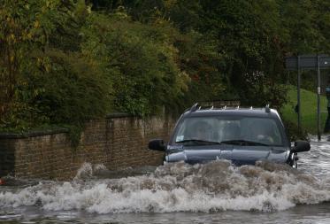
The wettest period from May to June since precipitation records began in 1766 brought widespread flooding to parts of England in June and July 2007 and demonstrated the difficulties of managing the risks of rain induced flood. By Alison Craig
A slowly moving depression brought heavy rainfall and local flooding to northern England on 15 June. A second depression crossed the Midlands and eastern England on 25 June, bringing more torrential rain. With the ground already saturated, major flooding followed across many parts of England and Wales.
On 20 July, there was more heavy rain. Extensive flooding followed in Gloucestershire, Worcestershire, Wiltshire, Oxfordshire, Berkshire, London and South Wales. In Gloucestershire, the River Severn burst its banks, completely cutting off the town of Tewkesbury. More than 50,000 people in the county lost their electricity supply and 450,000 were without drinking water, some for nearly three weeks. (For more details on the UK floods, see our event report on page 41).
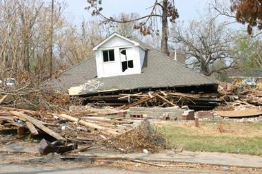
As of 7 August, total insured losses arising from the June and July floods were estimated close to £3 billion ($6 billion), evenly spread between the events.
Robert Muir-Wood, chief research officer at catastrophe modeller Risk Management Solutions (RMS), says, "This summer's floods have exposed many shortcomings in flood risk management and the location of critical infrastructure like power stations and water treatment plants, which have been shown to be vulnerable.”
RMS believes that existing national flood risk maps – as used by councils and property developers – are incomplete, omitting both sheet flooding caused by inadequate drainage, as well as flooding from minor streams. It says that extreme flood return periods employed for designing flood defences are based on river flows measured over the past half century that may already understate an increase in the hazard of extreme rainfall events associated with climate change.
The Association of British Insurers (ABI) has called for an urgent review of urban and rural drainage maintenance, and better co-ordination of flood risk modelling and mitigation. ABI director general Stephen Haddrill said that inadequate maintenance of watercourses and drains meant that flooding occurred in places that were not predicted by Environment Agency maps.
“This makes it very hard for us to determine the level of risk associated with a specific property,” he wrote to the Hilary Benn, Secretary of State for Environment, Food and Rural Affairs on 14 August.
Muir-Wood comments, “Unless the true level of flood risk is assessed accurately, effective measures cannot be put in place to manage and mitigate the risk, such as building and maintaining flood defences and making properties more resilient.”
Not uncommon
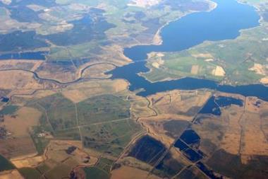
Rain induced or pluvial floods are not uncommon in the United Kingdom. RMS flood modelling since 2003 shows that close to a third of average annual flood losses come from sources outside the major floodplains.
Far more extensive flooding occurred in March 1947, when nearly all the main rivers in the south, midlands and northeast of England were affected. Such flooding, if it occurred today, would result in insured losses of £4.5 to £6 billion, according to RMS. Flood insurance was not widely available until the 1960s, and there are doubts whether UK insurers will continue to provide almost universal flood cover in future.
The ABI has reiterated its call for the government to reconsider new developments on floodplains. “Insurers will in future scrutinise new developments more closely and warn of potential uninsurability more robustly,” Stephen Haddrill wrote to
Hilary Benn.
The UK government responded to the summer 2007 floods by adding £200 million to spending on flood defences to bring the total up to £800 million by 2010-2011, and it initiated a review of the management of the floods and the way public bodies, such as the Environment Agency, local authorities and the emergency services, had responded.
The government has also strengthened the coastal flood and erosion role for Environment Agency, which will now take the lead in managing all sea flooding risk in England, and fund and oversee coastal erosion works undertaken by local authorities. Previously, there had been a mix of responsibilities between the agency and local government.
Postscript
Alison Craig is a freelance journalist
Email: alison.craig@cat-risk.com
www.cat-risk.com