


On 26 November 2007, the new European Directive on the assessment and management of flood risks entered into force. For the first time, EU legislation requires its members to plan strategically to reduce the adverse consequences of flood events on human health, economic activities, the environment and cultural heritage. By Maria Brättemark
Each of the 27 EU member states is now required to assess the flood risk in all its water courses, lakes and coastlines, to map flood hazard and flood risk, and establish plans for the management of flood risk . Member states are also required to coordinate with their neighbours in shared river basins and to integrate flood risk management with overall integrated water management .
The initiative to develop EU legislation in the field of flood risk management followed serious floods in many European countries in the late 1990s and early 2000. After rapid negotiations, the new directive was agreed in April 2007. This means that citizens and business all over the European Union can be assured that member states are taking the same steps to ensure flood risk is reduced.
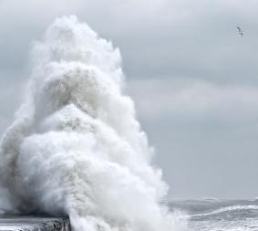
Given the diversity of Europe's rivers, lakes and coastlines and, therefore, the varied kinds of floods that can occur – river floods, coastal storm surges, tsunamis, flash floods and the more rare groundwater floods – the Flood Directive gives member states much flexibility in designing their plans, provided that their objective is to reduce the adverse consequences of floods and that they address a number of key issues.
The three tools
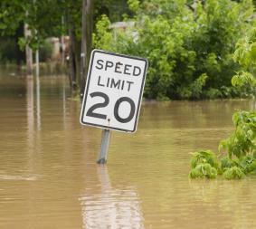
First, member states must carry out a preliminary flood risk assessment, which aims at identifying areas where there are significant flood risks that need to be reduced. This assessment should cover all the territory of the member states and all types of floods, with the exception of those arising exclusively from sewerage systems. The assessment is to be based not only on information on past floods and the risk they would entail today, but also studies of the potential impacts of climate change on flood risk in the future. This first needs to be undertaken by end of 2011.
Two years later, the areas selected should be mapped. The flood hazard maps are to include as a minimum the flood extent and associated water depths for a medium probability flood, at least a 100 year event, as well as a low probability or extreme event flood. Where appropriate, a high probability flood should also be mapped. The flood risk maps for these scenarios are supposed to indicate the likely population and the economic activities at risk, and certain indicators of potential environmental damage, such as the location of large industrial installations, areas for drinking water abstraction and protected sites under the Habitats Directive.
In 2015, the flood risk management plans need to be prepared. They will aim at reducing the adverse consequences of floods and must contain measures to achieve this objective, with a focus on preparedness, protection and prevention. The directive gives member states a high degree of flexibility on the details of such plans, but they must comply with a key set of principles. The plans need to be developed in coordination with other member states sharing the same river basin, and may not include measures that significantly increase the flood risk up or down stream, unless the member states concerned have agreed it.
Each of these steps shall be reviewed every six years, allowing adaptive flood risk management, which will grow in importance in view of climate change. For these stages, it is possible under certain circumstances for member states which are more advanced to use existing tools in the first implementation cycle. First, however, the directive is being transposed into member states’ national legislation and reporting formats are being developed together with the European Commission.
The plans will also need coordination with the river basin management plans required by the Water Framework Directive. This directive includes important provisions related to flood risk management. They include regulations governing the circumstances under which member states may modify the characteristics of a body of water, such as by building a new dyke or dam, even if it would lead to a deterioration of that body, in terms of the status criteria under the Water Framework Directive. These criteria are the ecological and chemical status for surface waters, and chemical and quantitative status for ground waters.
To strike the right balance between human safety and the environment, the Water Framework Directive lays down a transparent procedure, including the identification of the best environmental option for flood risk management. This is crucial to the development of sustainable flood risk management. Other provisions of this directive include actions to reduce environmental damage from flood. A number of issues need to be considered in the flood risk management plans under the Floods Directive, such as spatial planning which, is a crucial component of flood risk management.
All interested parties will also have the right to participate in the planning process and are entitled to at least six months to comment in writing on the draft flood risk management plans. Member states are encouraged to involve the public actively in this process. Once finalised, the preliminary flood risk assessment, the flood hazard and risk maps, as well as the risk management plans, must be made available to the public.
Linking with other EU initiatives
The Floods Directive is not an isolated initiative, but connects with various other strands of European Community action, and it is one of the important pillars of community action on climate change adaptation. For disaster protection, for example, the requirement to develop early warning systems will be important. In addition to the links to water legislation, the plans need to include flood risk management-related elements from other European legislation, for instance, the Seveso Directive, which deals with major industrial hazards, as well as the Strategic Environmental Assessment and Environmental Impact Assessment Directives. An important EU initiative is the European Union Solidarity Fund, which supports the recovery phase, while the Floods Directive will focus on the prevention, preparedness and protection phase of the flood risk management cycle. The Flood Directive is not linked to a funding programme, but to some extent, regional and structural funds can support risk management measures, mainly in the new member states.
Information exchange on implementation
This directive poses new challenges for flood risk managers across the European Union, and phase, a working group of member states, and stakeholders, flood experts has been established to support the implementation. This group is, for instance, the focal point for the exchange of information on important issues, such as sustainable land use practice, flood mapping and climate change. The stakeholders active in this group include the insurance industry – via the European insurance and reinsurance association (CEA) and environmental organisations, such as the World Wide Fund for Nature and the European Environmental Bureau.
Postscript
Maria Brättemark is the desk officer responsible for the Floods Directive in the unit for protection of water and the marine environment of DG Environment of the European Commission.
The European Commission's web pages on water and flood risk management are at: http://ec.europa.eu/environment/water/flood_risk/
index.htm.


No comments yet